Proposed map shifts lines in Bradford Districts 1, 3

Starke’s city limits are shaded in blue, while the area proposed to move from Distrit 1 to District 3 is shaded in yellow. The district dividing line east of Starke would move north from State Road 16 to Northeast 173rd Street, Northeast 12th Avenue and Northeast 171st Street.

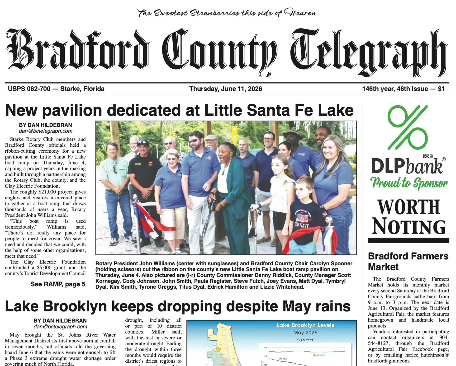
BY MARK J. CRAWFORD

Telegraph Editor

STARKE — Bradford County Commissioners took a first look at a proposed map that moves a portion of District 1 east of Starke into District 3.

In an effort to complete redistricting of the county and school board districts following the 2020 census, Supervisor of Elections Amanda Seyfang and her deputy supervisor, Matt Barksdale, have been looking at the preliminary and historic numbers.

This is unrelated any changes to the city of Starke’s districts that may occur as a part of its redistricting work in the coming year.

East of the Starke city limits, Districts 1 and 3 are divided by State Road 16. The proposed map shifts that line so that, east of the city limits, the district line moves north to Northeast 173 Street, Northeast 12th Avenue and Northeast 171st Street.

It is a small change that helps preserve District 1’s minority population as a majority of the voters, even if it doesn’t do much to balance the populations among all five districts.

Following a 1980s lawsuit filed by the NAACP, the county commission and school board agreed to create a majority minority district in order to help elect diverse leadership.

According to the elections office, the average district voting-age population of all five districts is currently 4,189 people. District 3 is furthest from the average on the high end with 336 more voting age residents, or 8% more. District one has the fewest voting-age residents and is 1,882 people below average, or nearly 45% fewer residents.

The county has found preserving a majority minority population in a single district more difficult as the population of African American citizens has become less geographically concentrated. The result is that District 1 is “artificially small,” according Will Sexton, county attorney.

District 1 will become smaller if the new map is adopted, but the minority population will grow from 48% to 51.5%, according to Barksdale.

The other option, of course, is to increase the size of District 1 to boost the minority voting-age population, but Sexton said even if that were possible it would be “very difficult” or result in an unusually shaped district.

“In essence, what has happened, it seems, is that the minority population has spread more evenly across the county and isn’t defined in such small pockets as it may have been,” Sexton said. “It’s easier to take away majority population than it is to try to find enough of a census block pocket of minority population to add to it.”

The proposed map is the easiest, if not the only, solution, but Sexton said the input of county commissioners, school board members and the public will all be considered before any changes are finalized.

“We wanted to show you not just what the issue was but a potential way to resolve the issue, and to only impact two of the districts — not to create that sort of domino effect of moving people and then having to adjust all the district boundaries to correct that,” Sexton said.

A special meeting on redistricting will be planned to hear further comments.